Dairy McKay Watershed
The Dairy-McKay watershed (DMW) (HUC-10: 1709001003), located in Northwestern Oregon, is part of the Tualatin Subbasin (HUC-8: 17090010). It encompasses an area of 471 square miles draining into the Tualatin River. The DMW is characterized by presenting peaks and mountains in the northern part and flat topography in the southern. The highest elevation corresponds to 2,265 feet (690 masl), while the lowest one corresponds to 115 feet (35 masl) at the confluence with the Tualatin River. Characterized by having perennial flow, DMW is considered one of the main tributaries of Tualatin River, which is the prominent channel within the watershed.
Below are some links you can use to learn more about the watershed landscape, and opportunities for implementing conservation practices. Check them out!
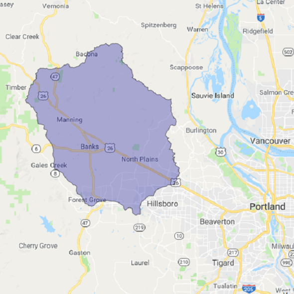
OutlineThis image shows the boundary for Dairy-McKay Watershed (HUC-10). WRESTORE has been currently set to investigate implementation of conservation practices in this catchment area of the Dairy-McKay Watershed. |
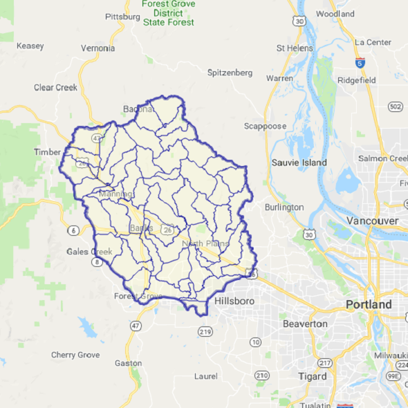
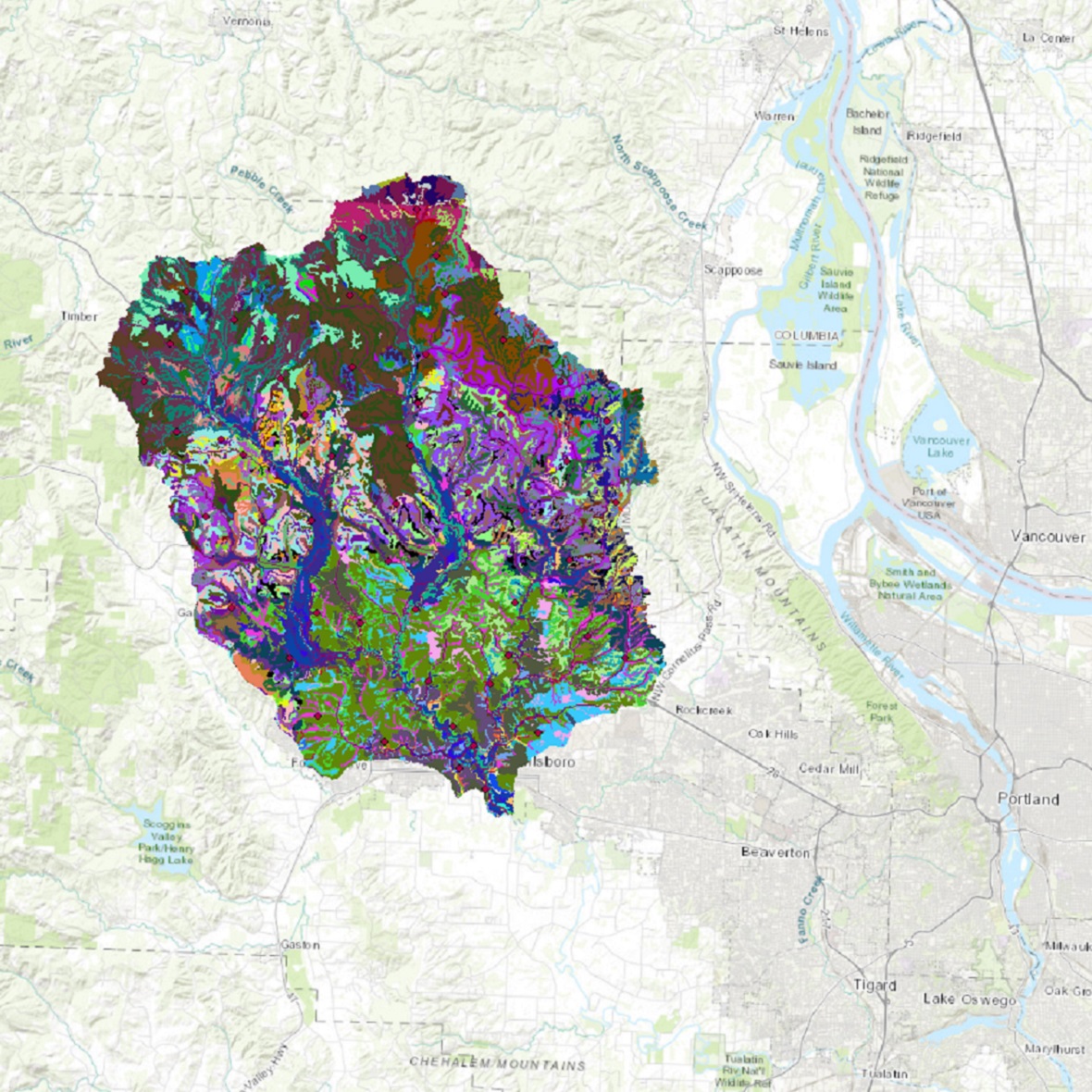
Sub-basinThis image shows all the 52 sub-basins in the watershed identified using the United States Geological Survey topographic map. These sub-basins are connected to each other based on the topography and are used to calculate the flow of water from upstream areas to downstream areas. |
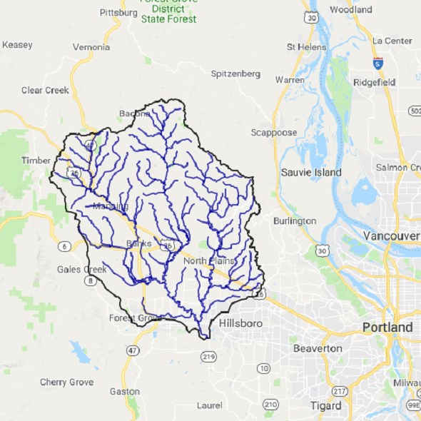
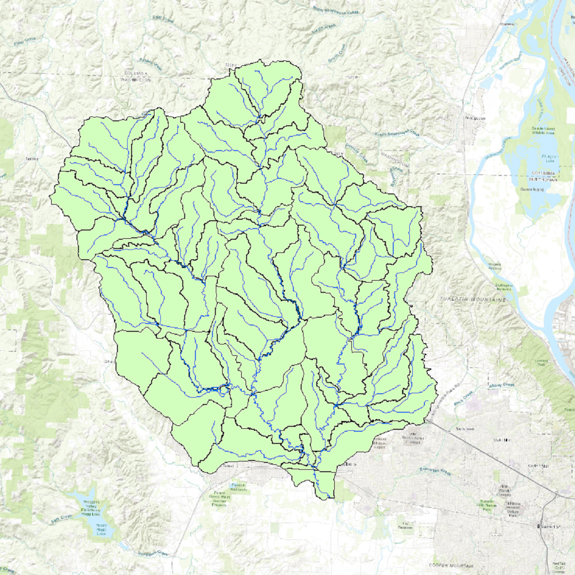
StreamsThis image shows the various streams and tributaries (and some main ditches),that build the stream network of Dairy McKay Watershed. |
Potential StorageThis image shows the various sites (depicted by polygons) on agricultural land where runoff will tend to accumulate because of depression in the topography, and low infiltration properties of the soil. Though the landscape also has many smaller sites where runoff accumulation can occur,this image only shows sites with areas of polygons greater or equal to 1000 square meters (i.e. 0.25 acres). These sites provide excellent opportunities for creating water storage practices such as wetlands, ponds, etc. that slow, store, and treat runoff. This helps in not only preventing erosion and fertilizer losses, but also helps improve availability of water in the landscape for crop use during dry seasons. |
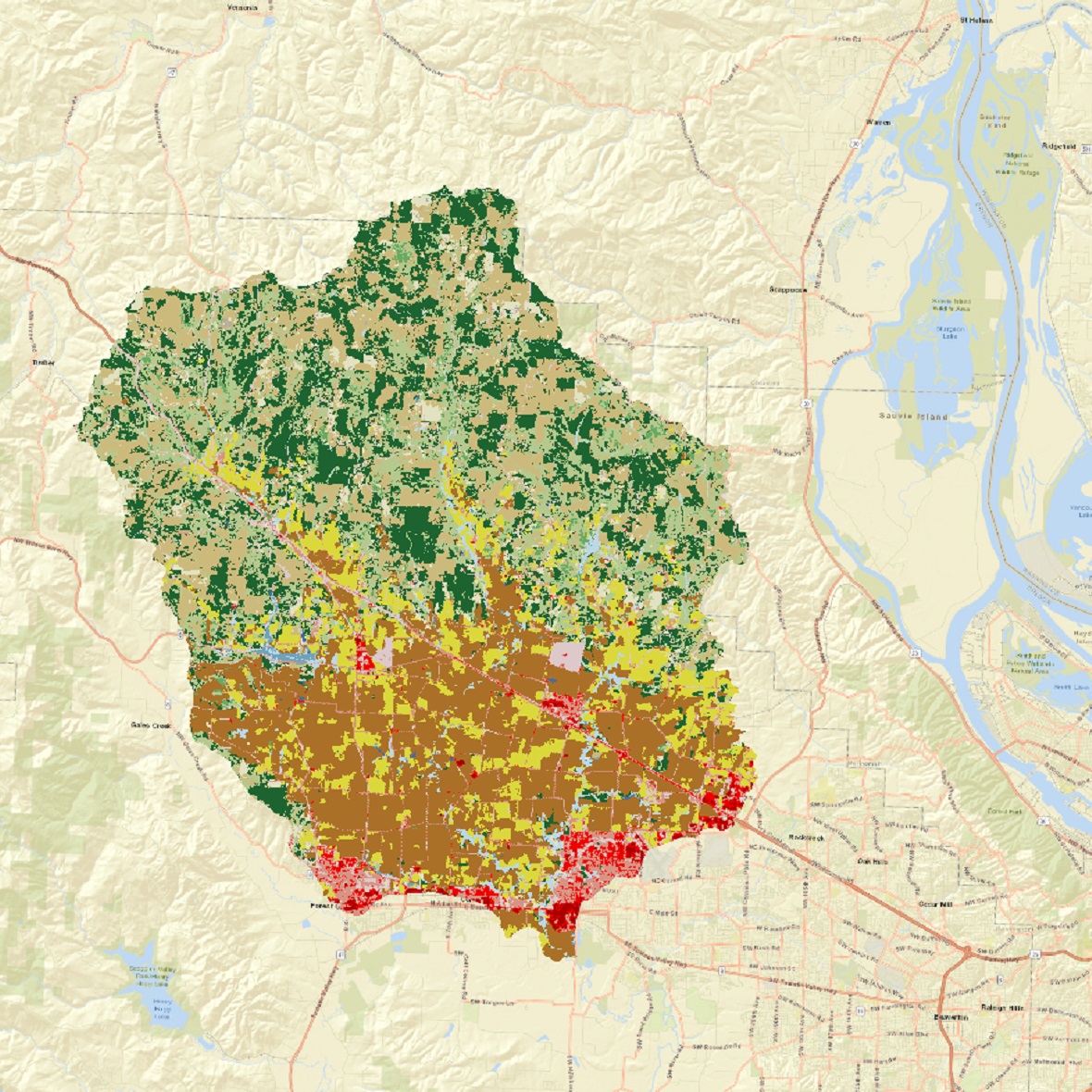
Land Use Land CoverageThis image shows the land use land cover in the Dairy McKay Watershed, observed in 2008. The data for this image was obtained from the United States Department of Agriculture – Natural Resources Conservation Service. |
SoilThis image shows the various soil types and their drainage characteristics in the Dairy McKay Watershed. |
